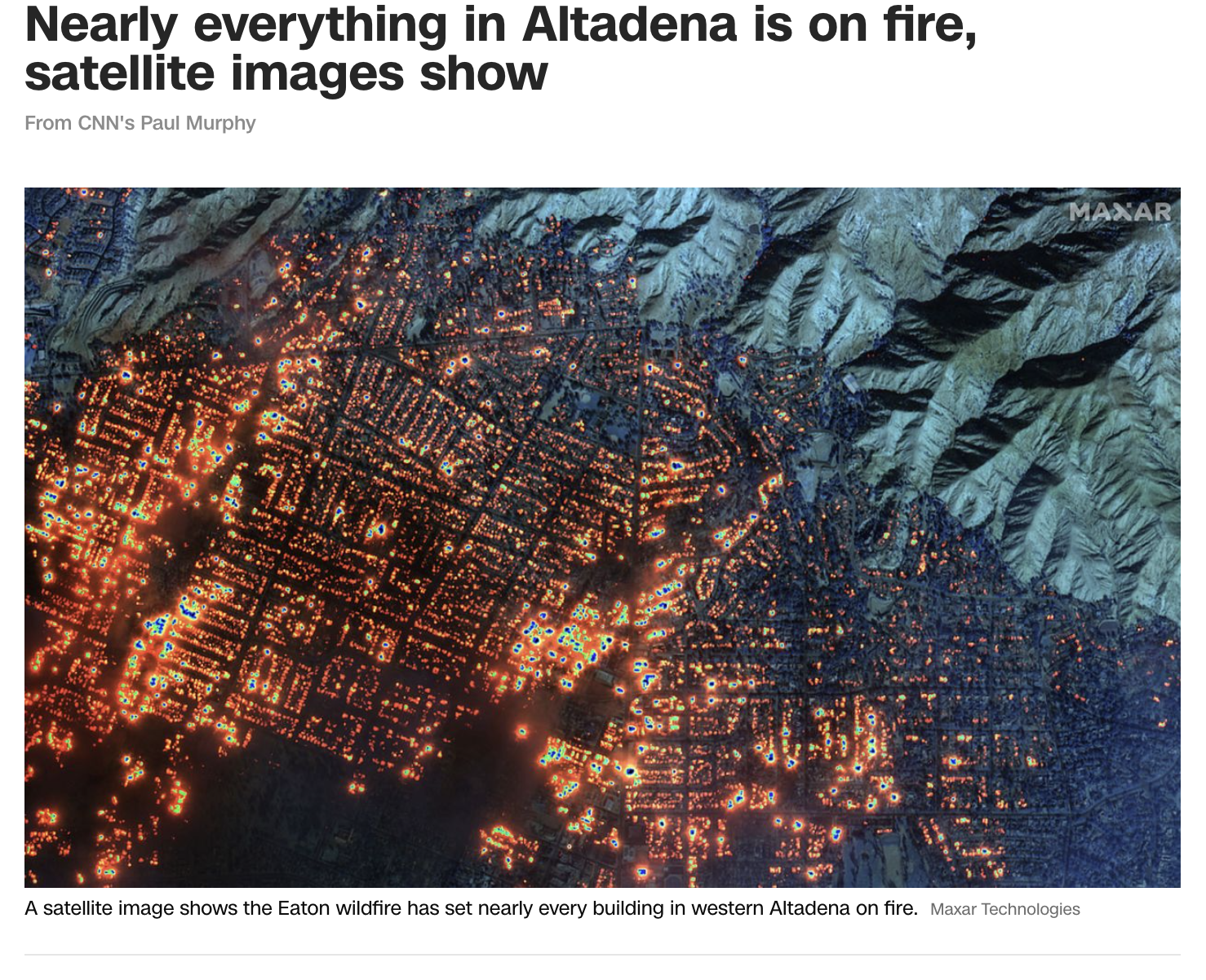
CNN published a satellite image acquired by the Maxar satellites at 10:45 a.m. PT on January 7. They used the short-wave infrared channels to see the fires through the smoke and clouds. It is a devastating view of almost every house burning over most of the western half of Altadena, California.
https://www.cnn.com/weather/live-news/los-angeles-pacific-palisades-eaton-wildfires-01-08-25#cm5on5ljn00053b6nfv5v500t

Comments
Displaying 0 of 0 comments