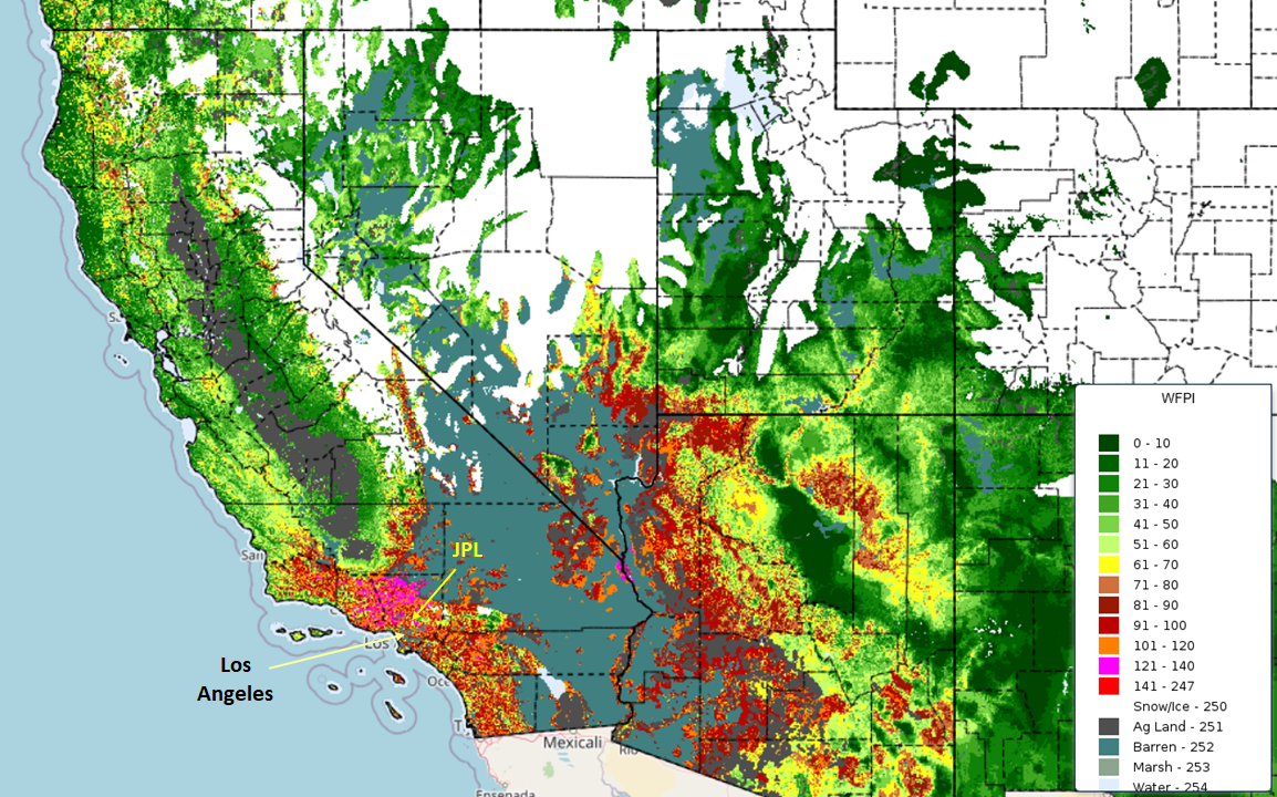
The Wildland Fire Potential Index (WFPI) from the USGS forecasts the risk for large fire activity across the U.S.
It is a unit-less number that ranges from 0 to 150 and relates to vegetation flammability. It describes the ratio of live to dead fuel and includes variables for wind speed, dry bulb temperature, and rainfall.
The wildfires in the L.A. area are not unexpected. The WFPI values around L.A. are mostly in the red zone. The Santa Ana winds spread the fire.
https://firedanger.cr.usgs.gov/viewer/index.html
4/n

Comments
Displaying 0 of 1 comments
AkaSci 🛰️
In response to this postThe wildfire situation around JPL looks very dire. This is a map of the wildfire in the area over the past 12 hours from the NASA FIRMS system. Note that there are a lot of residential areas underneath that red blob.
We are certainly not prepared for natural disasters like this. We will be even less so after the new fossil-fueled, ravenous billionaire infused, sociopathic administration takes over.
https://firms.modaps.eosdis.nasa.gov/map/#m:advanced;d:2025-01-08%2014:10..2025-01-09%2002:10;l:fires_landsat_landsat,fires_modis_aqua,fires_modis_terra,fires_viirs_noaa20,fires_viirs_noaa21,fires_viirs_snpp,countries,earth;@-118.13,34.20,12.98z
5/n
Likes: 0
Replies: 0
Boosts: 1